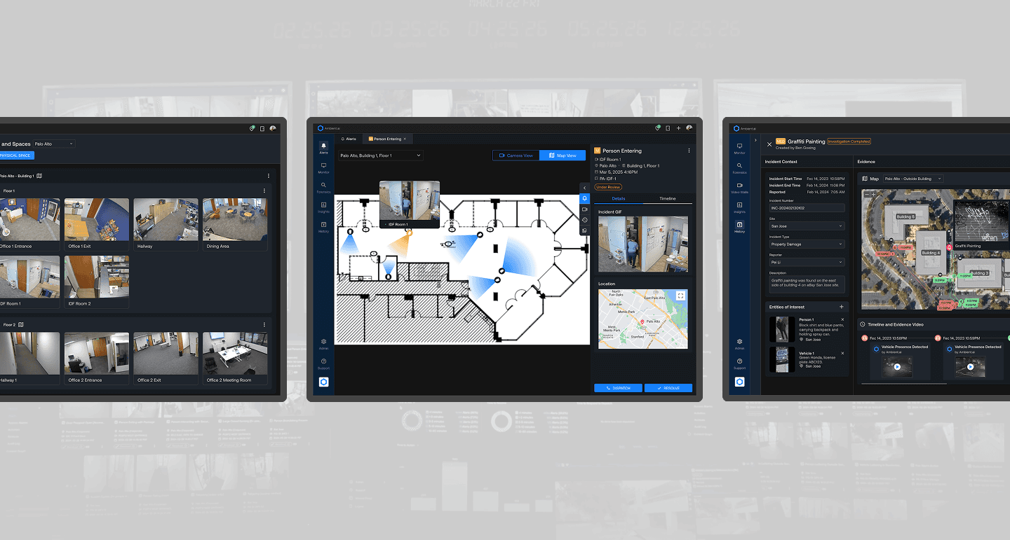
Geolocation Intelligence
Enabling real-time spatial awareness for security operations
Team:
1 Product Manager
1 Product Designer
2 Software Engineer
Timeline:
6 weeks
2025 Q4
Production
Contribution:
Design Roadmap
Visual Design
Interaction Design
Design & Impact
As the sole designer, I drove the product from early research through execution, defining a four-phase roadmap and delivering key experiences across onboarding, camera management, and alert response in close collaboration with cross-functional teams.
12k+
Cameras Mapped
18%
26
Customer Production
Highlights
Map Controls
Camera Field of View Adjustment
Alert Geolocation
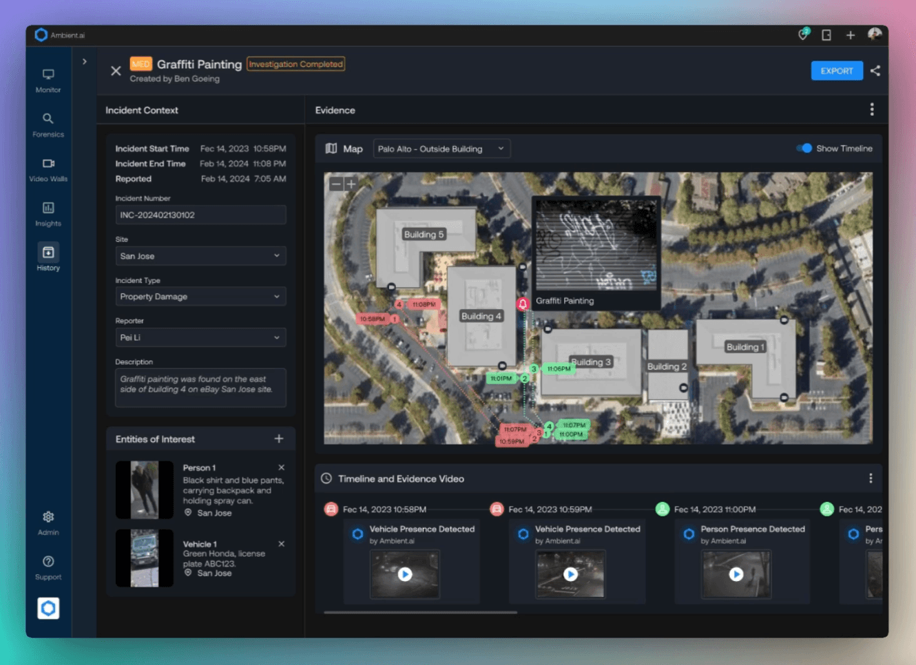
Mapping Timeline in Case Management
Context
Background
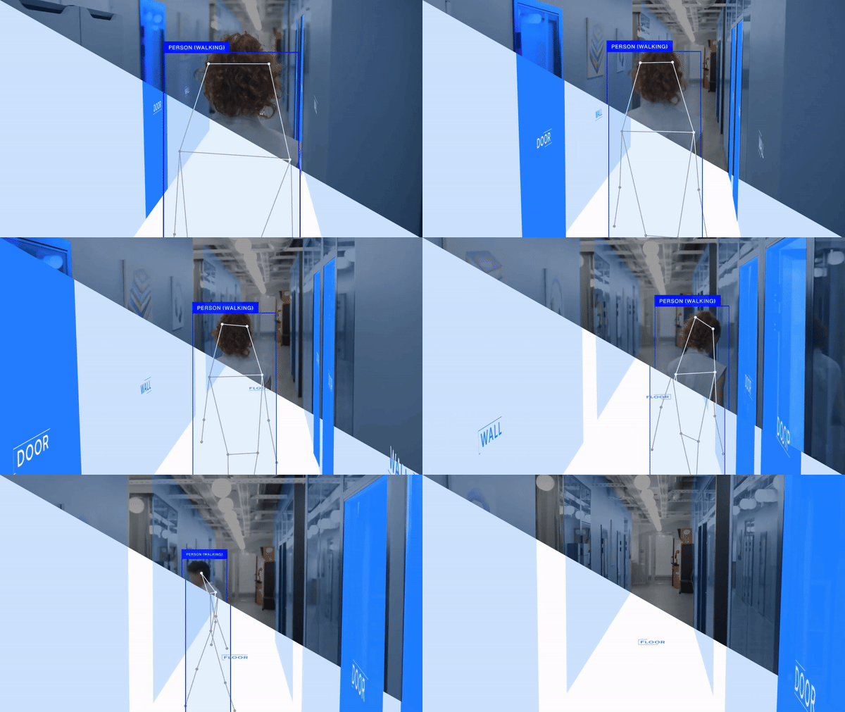
Ambient AI is a security platform powered by computer vision and vision-language models. Security operators use the system to monitor cameras, investigate incidents, and respond to real-time alerts.
Persona & Pain Points
Security operators monitor camera networks and investigate alerts, while responders handle incidents on-site. Their biggest challenge is not knowing the exact location of a camera or alert, which slows response and reduces operational efficiency.
Design Goal
Product Roadmap & Design Objectives
This project focused on mapping cameras and geolocating alerts, two key milestones within a broader four-step roadmap.
🗂️ 1. Organize Spaces (2024 Q3-Q4)
Create a structure to group adjacent cameras for clearer spatial understanding
📍 2. Camera Mapping
Place cameras and adjust field of view on a visual map for easier navigation
🔔 3. Alert Geolocation
Show alert locations and dispatch the nearest responder to improve time-to-resolve
🔎 4. Case Management (2026 Q2-Q4)
Collect and display incident evidence on the map for case management
Features
1 Uploading a floor plan
Based on the physical space hierarchy, users can upload floor plans at the floor level, creating a structured foundation for camera placement and spatial awareness.
2 Map View Controls
Interactive controls—including zoom, reset, and fit-to-window—along with a mini-map enable seamless navigation of complex floor plans.
3 Camera Placement and Management
Drag-and-drop camera placement with adjustable fields of view allows users to efficiently configure and oversee spatial coverage.
* Edge Case: Replace / Delete Floor Plan
Users can choose whether to retain mapped cameras when replacing a floor plan, preserving positions or remapping them as needed.
4 Alert Geolocation and Response
Drag-and-drop camera placement with adjustable fields of view allows users to efficiently configure and oversee spatial coverage.
Next Step [Vision Design]
In Q2–Q3 2026, we plan to enhance case management by visualizing the full timeline of each incident case on the map. This will allow security operators to see all collected evidence in context, making it easier to review and understand each case.
Retrospective
⚖️ Balancing Complexity and Usability
Working on camera placement and map interactions showed me how to build powerful features that remain clear and intuitive.
🔁 End-to-End Ownership
Leading the project from research to implementation taught me how holistic thinking and cross-team collaboration drive meaningful results.
📈 Impact Through Metrics
The 18% reduction in time to resolve showed how introducing geolocation can directly improve operational efficiency. Tracking this metric helped validate the design decisions behind the floor plan experience. It also reinforced the importance of using data to measure impact and guide future iterations.